CENTIMETER ACCURATE MAPPING - Achieve pinpoint 2cm GPS accuracy with RTK Multi-GNSS for flawless surveying.
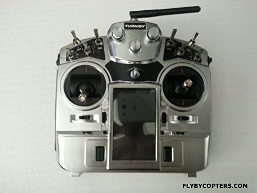
REAL TIME FLIGHT DATA FPV - Monitor live telemetry and HD video on a 7" FPV screen with on-screen overlays.
SEAMLESS AUTOPILOT MISSIONS - Plan and execute complex waypoint flights effortlessly via the intuitive ground station.
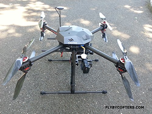
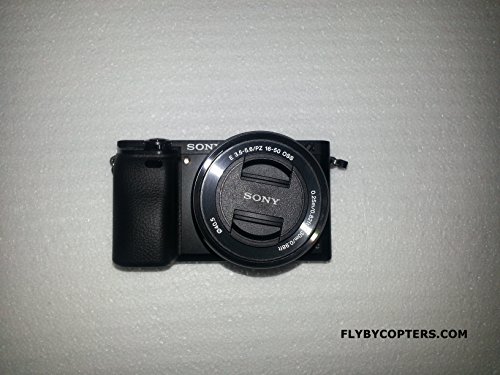
The Surveying/Aerial Mapping X8 Quadcopter Drone combines a Pixhawk 32bit autopilot, RTK Multi-GNSS GPS with 2cm accuracy, and a Sony A6000 high-resolution camera to deliver professional-grade aerial mapping and surveying. Featuring a carbon fiber frame, 3-axis brushless gimbal, and a comprehensive ground station with live telemetry and FPV, it enables precise, automated flight missions with real-time data overlay. Ideal for professionals demanding accuracy, efficiency, and stunning geotagged imagery.
Häufige Fragen
TrustPilot
TrustScore 4.5 | 7.300+ Bewertungen
Sneha T.
Habe mein Produkt in makellosem Zustand erhalten. Insgesamt toller Service.
vor 1 Monat
Markus B.
Die MOLLE-Scheide ist von außergewöhnlicher Qualität. Sehr zufrieden mit meinem Kauf.